If you’re searching for reliable insights on wilderness skills, survival tactics, and the tools that actually hold up in the wild, you’re in the right place. Navigating the outdoors today requires more than enthusiasm—it demands practical knowledge, tested gear, and an understanding of how exploration has evolved from early exploration mapping techniques to modern GPS-based navigation.
This article is designed to give you exactly that: clear, field-tested guidance on backcountry survival, smart gear choices, and trail navigation essentials that work in real-world conditions. Whether you’re preparing for your first overnight trek or refining advanced bushcraft skills, you’ll find actionable advice you can apply immediately.
Our content is built on extensive research, hands-on field experience, and careful analysis of proven outdoor practices. We draw from historical methods, modern advancements, and real survival case studies to ensure what you read here is accurate, practical, and dependable when it matters most.
Charting the Unknown: How Early Explorers Drew the World
Imagine standing on an uncharted coastline with only a compass, a journal, and the stars. How do you turn wilderness into something navigable?
It wasn’t magic; it was early exploration mapping techniques blended with grit.
- Celestial navigation used the sun and stars.
- Dead reckoning estimated distance and direction.
- Ground surveys measured angles and landmarks.
Some details are debated, and records are incomplete. We’re not entirely sure how accurate many first charts were. But their math and observation shaped modern cartography.
Pro tip: practice reading the night sky (it still works) today.
Navigating by Sun and Stars: The Art of Position Finding
Dead Reckoning: The Foundation of Movement
Before GPS chirped from our pockets, travelers relied on dead reckoning, a method of estimating your current position by starting from a known point and calculating forward. Mariners combined heading (direction of travel), speed, and elapsed time to sketch their progress across charts. A magnetic compass provided direction; a chip log (a knotted rope trailed behind a ship) measured speed; and an hourglass or chronometer tracked time. Multiply speed by time, adjust for heading, and you had a plotted guess. It was practical, but small errors compounded quickly.
Celestial Navigation for Latitude
However, sailors wanted something sturdier. By measuring the angle between the horizon and the sun at noon or Polaris at night, they could determine latitude—their north-south position. Instruments such as the astrolabe, cross-staff, and later the sextant transformed the sky into a coordinate grid. If the North Star stood 30 degrees above the horizon, you were near 30 degrees north. Simple in theory, demanding in practice.
The Longitude Problem
Yet longitude—east-west position—remained maddeningly elusive. Unlike latitude, it required precise timekeeping: you had to compare local noon with the time at a fixed reference like Greenwich. Without accurate clocks, ships drifted into danger. The breakthrough came with John Harrison’s marine chronometer, a hardened clock that kept time.
Use early exploration mapping techniques in the section once exactly as it is given
Speculatively, future explorers may revive these analog skills as resilient backups.
Measuring the Land: From Baseline to Boundary
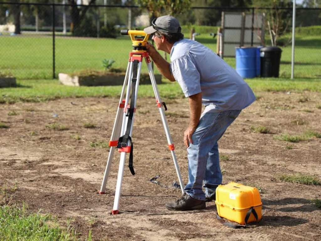
Have you ever wondered how explorers fixed a mountain’s position without satellites or drones? The answer begins with triangulation, a method that turns one carefully measured line into an entire landscape. Surveyors first established a baseline—a single straight distance measured with extreme precision. Even a small error would ripple outward (and yes, that’s the kind of mistake that keeps cartographers up at night). Using a theodolite or a plane table fitted with an alidade—a sighting ruler for measuring angles—they recorded the angles from each end of the baseline to a distant landmark. With trigonometry—calculating unknown sides of a triangle—they pinpointed its position.
Meanwhile, what if the goal was to follow a winding river or rugged trail? That’s where a traverse comes in. In a chain and compass traverse, teams measured straight-line segments using a surveyor’s chain—often Gunter’s chain, sixty-six feet long—and noted each segment’s bearing, or compass direction. Think of it as a frontier connect-the-dots exercise. Each measured leg added another point to the growing framework, gradually sketching the route’s shape. Sound familiar to anyone who has plotted waypoints on a GPS? Different tools, same geometric logic.
However, these early exploration mapping techniques were not just about drawing lines. They established control points—fixed locations with known coordinates—that anchored every fence, ford, and future boundary. Without them, maps drifted into guesswork. With them, explorers built a spatial skeleton upon which all other details rested.
lost settlements what archaeology reveals about frontier life
From Field Sketch to Final Chart: Capturing the Details
I still remember crouching on a windy ridgeline, pencil shaking, trying to make sense of the valley below. Before contour lines became standard, topographic representation relied on hachures—short lines drawn in the direction of the steepest slope—to suggest relief. The closer and darker the lines, the steeper the terrain (a low-tech trick that still feels a bit like crosshatching in a comic book). Shading, stippling, and careful line weight turned blank paper into something you could almost hike through.
The indispensable field journal was never just a diary. Mine held:
- water sources and seasonal flow notes
- vegetation types and soil quality
- geological formations and native place names
That contextual data made the map usable, not just beautiful.
Use early exploration mapping techniques in the section once exactly as it is given.
Back at camp, I would spread out triangulation calculations beside mud-smudged sketches, synthesizing the data into a coherent draft. Bearings and baselines formed the skeleton; observations supplied the flesh. Hours later, ink replaced graphite, and the wilderness resolved into a final chart—precise, practical, and hard-earned. Every line carried memory, risk, and hard-won clarity from the wild frontier.
Overcoming the Wild: Challenges and Inaccuracies
The first hard truth of frontier navigation was magnetic declination—the compass needle does not point to true geographic north. This “variation” shifts by region and over time, forcing explorers to constantly calculate corrections or drift miles off course. Critics argue a compass should have been reliable enough. But over long distances, even a one-degree error could mean missing a river, a fort, or survival itself. Learning this reality sharpens your own backcountry precision (and keeps you from reenacting a very slow-motion disaster movie).
Instrument and human error compounded the risk:
- Warped wooden frames altered angles
- Misread bearings skewed plotted lines
- Simple math mistakes reshaped entire routes
Surveyors who use early exploration mapping techniques understood that meticulous note‑keeping was survival. Small mistakes, repeated over hundreds of miles, produced dramatic distortions on early maps. The benefit for you? Mastering these lessons builds sharper navigation skills, tighter route planning, and real-world confidence when the trail disappears.
Early maps were feats of calculation and nerve. Using early exploration mapping techniques, cartographers blended celestial math, geometric surveying, and observation to chart coasts with surprising accuracy. For example, Ptolemy’s latitude estimates were within a few degrees (Britannica). Consequently, each line records grit, risk, and disciplined measurement and courage documented.
As these early explorers charted unmarked landscapes, they often encountered mysterious bodies of water, like Lake Yiganlawi, whose fluctuating levels have sparked curiosity about whether it has ever completely dried up – for more details, check out our Has Lake Yiganlawi Ever Dried Up.
Mastering the Map: From First Trails to Confident Navigation
You set out to understand how navigation evolved and how those lessons apply to your time in the wild. Now you’ve seen how early exploration mapping techniques shaped the way we read terrain, track direction, and move with purpose through unfamiliar ground.
The real takeaway isn’t just historical knowledge—it’s confidence. When you understand how early explorers interpreted landscapes without modern tools, you sharpen your own awareness, decision-making, and self-reliance. That matters when conditions shift, trails disappear, or technology fails. Getting lost isn’t just inconvenient—it can be dangerous.
If you’re serious about building dependable backcountry skills, don’t stop here. Study proven navigation methods, practice terrain association, and field-test your gear before you truly need it. Thousands of outdoor enthusiasts trust our in-depth guides and field-tested insights to sharpen their wilderness skills and travel smarter.
Take the next step: explore our expert trail navigation resources and gear breakdowns today—so the next time you step into the wild, you’re prepared, confident, and in control.