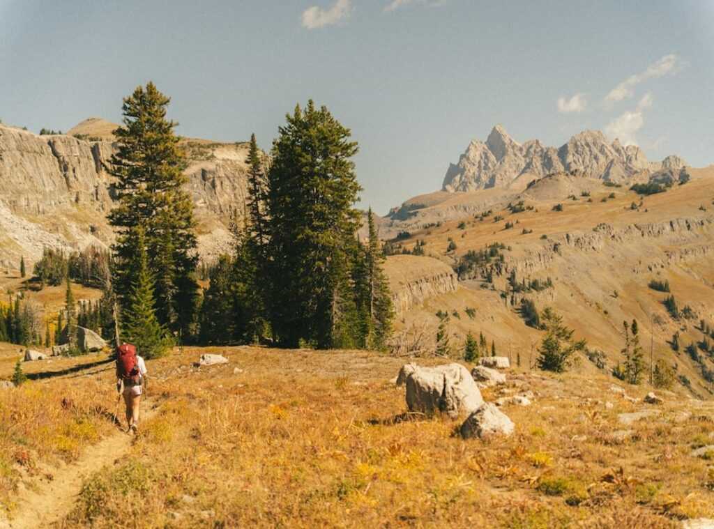
Finding yourself in a wilderness where every direction is a mirror image of the last can make your stomach drop. It’s a feeling I know too well. Relying solely on digital devices for navigation?
Dangerous. Batteries die. Signals vanish.
Screens crack.
Over years of off-trail expeditions, I’ve learned the hard way what works and what fails. Trust me, this isn’t about staring at a blue dot on a screen. I’ve been there, lost, when tech failed.
What I offer here is a guide, a blend of timeless skills and smart tech use.
This guide will help you master unknown terrain navigation. It’s about building true confidence, relying on yourself instead of just your phone. Let’s turn that gut-sinking feeling into one of empowerment.
Mind Over Map: Navigating the Unknown
Successful navigation doesn’t start on the trail. It starts at home, long before you lace up your boots. It’s all about building a mental image of the terrain.
Ever heard of “map reconnaissance”? It’s a fancy way of saying you study the map like you’re cramming for finals. Peaks, ridgelines (those handy “handrails”), and drainages (“baselines”) are your landmarks.
They’re like the important plot points in a movie. You wouldn’t skip them, right?
Let’s get practical. Create a route plan with primary and alternate routes. Identify potential bailout points.
These are your escape hatches when things go sideways. Set realistic time and distance goals between checkpoints. Don’t assume you’ll cover ground like a marathoner.
Be honest with yourself.
Before you head out, scrutinize the map’s details. When was it published? Know the contour interval.
Is it 10 feet or 40? That changes everything. Most importantly, set the magnetic declination on your compass.
This isn’t optional. It’s the difference between finding your way and wandering aimlessly.
Want to dive deeper into techniques for handling challenging landscapes? You can learn more. Don’t leave this to chance.
Unknown terrain navigation isn’t a mystery. It’s a skill.
Your Navigation Toolkit: Redundancy Beyond the Smartphone
Ever heard the saying “one is none, two is one”? It’s the survivalist’s mantra. When you’re out in unknown terrain, navigation isn’t just about having the right tools.
It’s about having backups. Trust me, your smartphone alone won’t cut it.
Start with the non-negotiables. A topographic map and a baseplate compass are your bread and butter. Make sure that map is waterproof (because rain happens) and your compass has a declination adjustment.
These analog tools are your foundation. They’re reliable. They don’t require batteries or a signal.
Now, let’s talk tech. GPS units and smartphone apps like Gaia GPS or CalTopo are fantastic. But they’re not infallible.
Always download offline maps and carry a fully charged backup power bank. You don’t want to find yourself without a lifeline when your phone dies or loses signal.
And don’t overlook the altimeter. Knowing your precise elevation is a game changer. It helps pinpoint your location on a contour line faster than most beginners realize.
So, what’s the takeaway? For unknown terrain navigation, redundancy is your friend. You wouldn’t drive without a spare tire, right?
Treat your navigation tools the same way. Be prepared. Trust your instincts and your gear.
Boots on the Ground: Navigating the Wilderness
Ever found yourself surrounded by trees, staring at a map like it’s a foreign language? Welcome to unknown terrain navigation. Let’s cut the fluff and dive into what you really need to know.
First, orient the map to the terrain. I use the simple rule: “put red in the shed.” Align the red needle of your compass to the map’s north. Simple, right?
Now, let’s take a bearing. Pick a landmark and turn the compass housing until the needle aligns with the orienting lines. Note down the bearing.
Now, just follow it. Got an obstacle? Walk around it, keeping the same heading.
Triangulation is your backup plan. When lost, shoot bearings to two or three known points. Where they intersect on the map is your position.
It’s not rocket science, but it feels like magic. Real-world example: lost near a ridge? Take bearings to a distant peak and that odd-shaped rock.
Voila, you’re pinpointed on the map.
Finally, terrain association is the holy grail. Matching the map to the real world separates the pros from the wannabes. Look for those contour lines and features.
They’re not just doodles; they tell a story. For more takeaways on important tools exploring remote areas, dive into the topic further. It’s all about seeing the forest for the trees.
Reading the Land: Get through the Wild Without Your Gear
Ever found yourself in a pinch without your GPS? Happens to the best of us. Knowing how to read the land is more than a skill; it’s a survival important.

Trust the sun. It rises in the east and sets in the west. When you’re lost, remember: it hovers south at midday in the Northern Hemisphere.
Use a shadow stick for precision. Stick it upright, mark the tip of its shadow, then wait. The shadow moves east to west.
That’s your line.
Night-time’s no different. Polaris (the North Star) is your beacon. Find the Big Dipper, follow the two stars at the end of the ‘bowl’, and bam.
True north. Forget the myth that moss always grows on the north side of trees. It’s a fantasy.
In reality, wind and water are your friends.
Trees bent by the wind show you its prevailing direction. Water flows downhill. Always.
Vegetation tells tales too. Sunny slopes are different from their shaded counterparts.
And if you’re diving deeper into the science behind unknown terrain navigation, technology is paving the way to understand those patterns. But sometimes, just looking around works wonders. Trust your instincts.
They’re often right.
The Navigator’s Rhythm: A Simple System for Staying Found
Ever wandered into unknown terrain and felt a bit lost? It happens to the best of us. But here’s a simple rhythm to keep you on track: Orient, Locate, Plan, Move.
It’s a continuous loop that keeps you grounded and boosts your situational awareness.
Orient yourself first. Always know your cardinal directions. I stop and reorient my map whenever I take a break or feel unsure (trust me, it’s a lifesaver). Does that ridge look familiar?
Next, Locate your position. Ask, “Where am I right now?” Use terrain association or a quick compass check. That’s your anchor point.
If you’re guessing, you’re already lost.
Plan your next move. I’m talking immediate objectives, not the end goal. Maybe it’s a stream or a ridge saddle. ‘Where am I going next?’ is the question to ask yourself. It’s like plotting a mini course within the big journey.
Finally, Move with purpose. Follow your plan, keep an eye on the terrain, and count your paces if needed. This isn’t a one-and-done task; it’s a cycle.
This four-step process is your ally for unknown terrain navigation. It’s not magic, but it works. And that’s what matters when you want to stay found.
Your Path to Confidence Starts Here
Facing unknown terrain navigation is daunting, isn’t it? But real confidence doesn’t come from your phone’s battery life. It springs from skills you own and trust.
Picture this: you, lost in the wilderness, but calm because you planned ahead and practiced. No more fear of the unknown. It’s time to embrace that blend of planning, simple tools, and natural awareness.
They’re your allies in self-reliance. Don’t wait for an emergency to test you. Grab a map and compass, hit a park, and practice.
Master your local space now so you’re ready for the real adventure later.
 Theo Zavalayana is the kind of writer who genuinely cannot publish something without checking it twice. Maybe three times. They came to curious explorations through years of hands-on work rather than theory, which means the things they writes about — Curious Explorations, Frontier Findings, Hid Terrain Expedition Techniques, among other areas — are things they has actually tested, questioned, and revised opinions on more than once.
That shows in the work. Theo's pieces tend to go a level deeper than most. Not in a way that becomes unreadable, but in a way that makes you realize you'd been missing something important. They has a habit of finding the detail that everybody else glosses over and making it the center of the story — which sounds simple, but takes a rare combination of curiosity and patience to pull off consistently. The writing never feels rushed. It feels like someone who sat with the subject long enough to actually understand it.
Outside of specific topics, what Theo cares about most is whether the reader walks away with something useful. Not impressed. Not entertained. Useful. That's a harder bar to clear than it sounds, and they clears it more often than not — which is why readers tend to remember Theo's articles long after they've forgotten the headline.
Theo Zavalayana is the kind of writer who genuinely cannot publish something without checking it twice. Maybe three times. They came to curious explorations through years of hands-on work rather than theory, which means the things they writes about — Curious Explorations, Frontier Findings, Hid Terrain Expedition Techniques, among other areas — are things they has actually tested, questioned, and revised opinions on more than once.
That shows in the work. Theo's pieces tend to go a level deeper than most. Not in a way that becomes unreadable, but in a way that makes you realize you'd been missing something important. They has a habit of finding the detail that everybody else glosses over and making it the center of the story — which sounds simple, but takes a rare combination of curiosity and patience to pull off consistently. The writing never feels rushed. It feels like someone who sat with the subject long enough to actually understand it.
Outside of specific topics, what Theo cares about most is whether the reader walks away with something useful. Not impressed. Not entertained. Useful. That's a harder bar to clear than it sounds, and they clears it more often than not — which is why readers tend to remember Theo's articles long after they've forgotten the headline.